
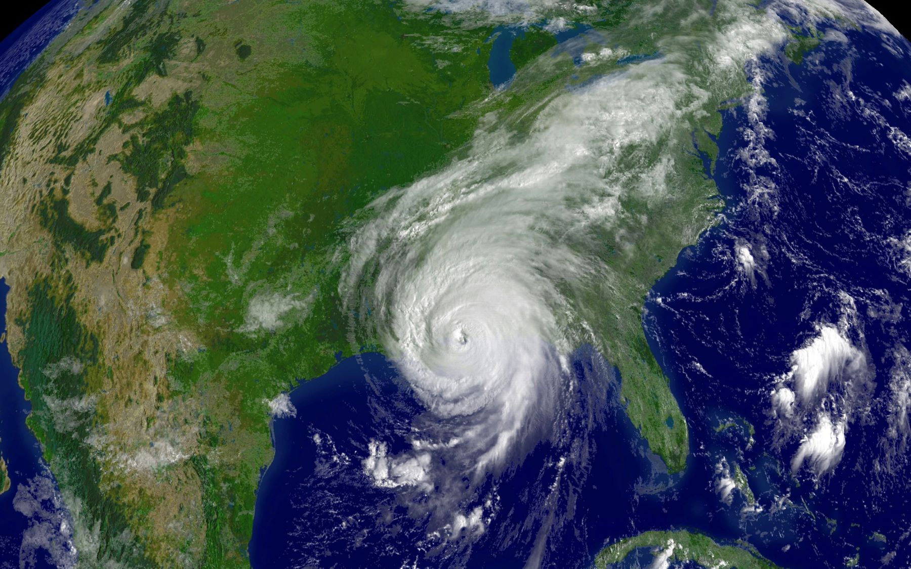
Las satellite images of various hurricanes and typhoons have allowed experts from Colombia and the United States to carry out joint research in order to analyze the internal core and, based on that data, predict the increase in its intensity.
He analysis of satellite images of 15 high and low intensity cyclones –such as typhoons María and Ampil, which hit Japan in 2018 and 2024 respectively– showed that when the inner core of the eye of the hurricane contracts, it causes the speed of the winds to increase, producing rapid intensification. This was announced by researchers from the National University of Colombia (UNAL) and the University of Maryland (United States).
The finding, presented during the II International Congress on Climate Variability and Change, organized by the Faculties of Sciences and Agrarian Sciences of the UNAL Bogotá Headquarters, improves the prediction of rapidly intensifying hurricanes, responsible for major damage in the world.
The objective of the study focused on characterizing these cyclones and hurricanes through the analysis of data from the Environmental Operational Geostationary Satellite (GOES), a project of the United States National Weather Service, and Himawari-8, a meteorological satellite operated by the Japan Meteorological Agency.
The work is carried out by students Jhayron Pérez, from the Master’s Degree in Meteorology at the University of Maryland, and Duván Nieves, from Environmental Engineering at the Faculty of Mines at UNAL Medellín Campus, and directed by Professor Carlos Hoyos, from the same Faculty.

During their speech at Congress, the researchers explained that “tropical cyclones that reach categories 4 and 5 on the Saffir-Simpson scale (which measures the intensity of hurricanes) with winds greater than 252 km/h are the most destructive and have seriously affected Colombian regions.”
Some of the most remembered are Joan, in October 1988 – who crossed the La Guajira peninsula and moved through the south of San Andrés; César, in July 1996; Mathew, in October 2016 – which moved through the north of the La Guajira peninsula –, and Iota, in November 2020. “With this work we seek to understand why these cyclones intensify so quickly, since today 80% of alarms turn out to be false, which generates loss of life and economic losses,” they point out.
Faster and more frequent hurricanes
Until now The study has focused on about 15 cyclones in the worldamong them Typhoon Maria, a powerful, high-intensity tropical cyclone that formed in July 2018 in the western Pacific Ocean, reaching category 5 on the Saffir-Simpson scale, with winds that exceeded 260 km/h. The phenomenon especially affected Taiwan, the Ryūkyū Islands of Japan and the southeastern coast of China, and although the coastal regions were the most damaged areas, it also caused landslides and significant economic losses in agricultural areas.
Another low intensity phenomenon was Typhoon Ampil, which formed in July 2018 in the Pacific Ocean.Today it affected Japan and China, particularly the eastern region of Shanghai, and although it did not reach the highest categories, it did cause flooding and the evacuation of thousands of people.
The student Nieves pointed out that “cyclones of rapid intensificationn present a contraction in the inner core, which increases the strength of the winds and concentrates the angular momentum causing them to intensify rapidly.”
According to experts, “we are confirming the theory of convection cycles in high-intensity tropical hurricanes, which is based on the principle of atmospheric convection, where hot air tends to rise and cold air to fall, creating air currents. The process is essential for the transport of heat in the atmosphere and is responsible for many climate phenomena, such as the formation of clouds and storms.
The thermal instability in the atmosphere, caused by temperature differencesfeeds these currents of conviction, thus affecting the climate in different regions. The research suggests that these findings could be implemented in dynamic and statistical predictive models to improve real-time forecasts. With satellite images updated every 10 minutes it would be possible to offer more accurate predictions and reduce uncertainty in alerts.
The researchers consider that the contributions of their work have great potential to mitigate the impact of tropical hurricanes in vulnerable regions like San Andrés. “We hope that these advances are implemented operationally in Colombia, and that they can then be extrapolated to other regions affected by these phenomena,” they concluded.
Climate change is changing the patterns that lead to the formation of typhoons, hurricanes and large storms. This implies that not only are they having greater intensity, but they form more quickly and appear in places where they were not known before. And according to climatologists, this is just beginning.