
The University of Alicante (UA) and the Polytechnic University of Valencia (UPV) have launched the MarinaInfo mobile application so that citizens can report bad practices at sea, such as illegal fishing or risky navigationBesides the presence of spills, plastics or invasive species.
The app was born with the objective of improving knowledge about the spatial planning of marine areas, their uses and also the safety of all users. It is part of what is known as citizen science projects, in which the general public actively intervenes in the scientific research process. In this case, through the new app, Users collect information and report bad practices with the aim of helping to protect marine biodiversity. The MarinaInfo app It is free and is now available for Android and will soon be available for iOS devices, according to a statement from the UA.
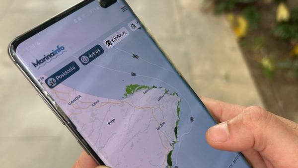
In this first phase, the application offers, among other information of interest, the mapping of Posidonia oceanica meadows on the coast of the province of Alicante, but the final goal is to be able to expand the content to the entire national territory. In addition, the team is already working on providing information to raise awareness about the importance of marine protected areas, as well as the regulation of these natural spaces designated for the protection of ecosystems in the marine environment.
«As users of the sea, where we often go out to sample, we are aware of the existence of risk situations due to navigation due to excess speed in areas where there may be divers, anchoring in unauthorized areas or fishing in prohibited areas«, have pointed out the UA researchers. In this sense, thanks to the collaboration of the entire society and professionals linked to the maritime sector, such as fishermen’s associations, diving or environmental associations, “unauthorized or nuisance activities facilitated through MarinaInfo can be reported anonymously with photos”, they have explained.
Notice to the authorities about illegal fishing or discharges into the sea
Each notice, which is automatically georeferenced by the application, is analyzed and, if it may contravene any regulations, inform the competent authority. Once the notice is received, “we study whether the facts reported could be an administrative infraction or some type of conduct that should be known by the competent administrations. For example, in a poorly marked beach area where boats sail into unauthorized areas, we will inform the corresponding town council to improve the marking to avoid risk situations for people,” the UPV computer scientists have pointed out.
The application It has been developed by researchers from the Department of Ecology and the Multidisciplinary Institute for the Study of the Environment “Ramon Margalef” of the UA César Bordehore y Eva Fonfríaand the UPV computer scientists Eduardo Blasco y Ramon Palacioswas born with the objective of improving knowledge about the spatial planning of marine areas, their uses and also the safety of all users.
It is not the first time that UA researchers and UPV computer scientists collaborate on a project of this type. In 2018, Medusapp was launched, the application that has allowed more than 36,000 jellyfish sightings to be reported thanks to the collaboration of citizens through their mobile phone. In addition to contributing to expanding scientific knowledge about the most common species along the Mediterranean coast, their seasonal patterns and spatial distribution trends, this application has become a tool to warn bathers about the presence of jellyfish in real time.