
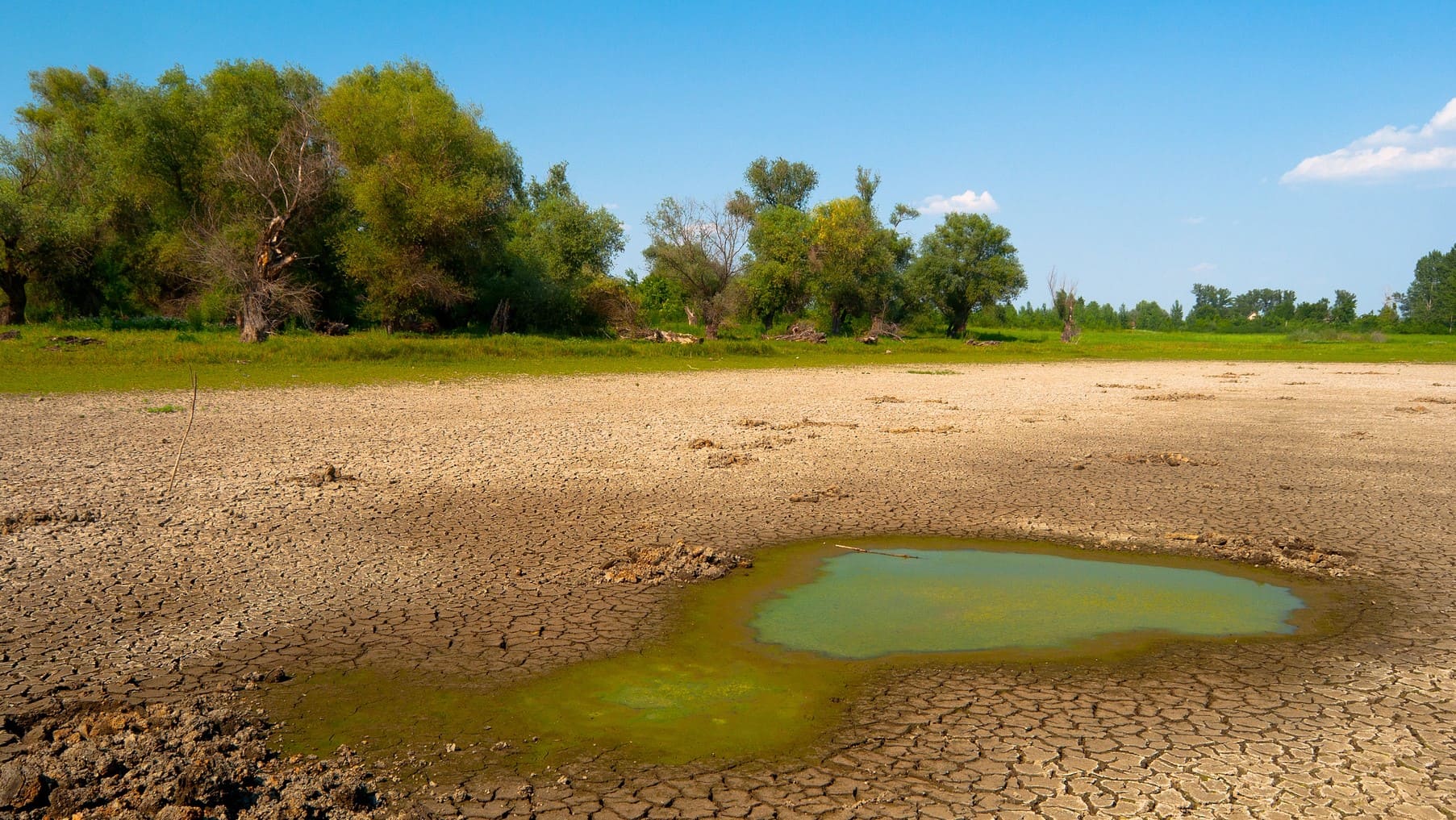
Further Three quarters of the earth’s surface suffered drier climates and environmental aridity between 1990 and 2024, compared to the previous three decadesaccording to the latest information from the United Nations Convention to fight desertification. In the last 30 years, 40.6 % of the world land mass, excluding Antarctica, is classified as arid lands, three percentage points more than the previous three decades.
These data also suggest that in the worst of the projected scenarios about climate change 2100, 5,000 million people could have to live in the desert due to the acceleration of global heating of anthropogenic origin that we are experiencing.
The Climate aridity is also a problem in Spain, so scientists study their recent evolution and Their future projection in a context of climate change and seeks how to develop information tools that allow them to manage the risk of desertification that the country is already experiencing.


Increased climate aridity in Spain
An investigation carried out by a team of the Climatology and Climate Services Laboratory, a network that brings together scientists and technicians from the Higher Council for Scientific Research (CSIC) and the University of Zaragoza, He has revealed that climatic aridity, that is, the long -term balance between water availability From the rain and water that evaporates the atmosphere, has increased discreetly, but continues, during the last 60 years in Spain. The conclusions of the work, funded by the Biodiversity Foundation, are published in the International Journal of Climatology.
The Climate aridity is a climate characteristic of a region that describes the shortage (or abundance) of rainfall in relation to the demand for water by the atmosphere. It has a broad impact on many aspects of life, and plays a key role in determining water availability and the geographical distribution of ecosystems and agricultural regions.
As explained by researchers, in current climate change conditions it is of great interest to evaluate changes in the aridity climate, since it is one of the main engines of ecological transitions, such as the desertification process.
According to the conclusions of the work, the Canary Islands have registered a clearer tendency towards a more arid climate, especially since 1990. Between 1961 and 1990 and 1991 and 2020, 12% of the territory of peninsular and Balearic Islands He experienced a transition to the most arid categories of the Aridity Index of the Food and Agriculture Organization (FAO)while there were barely transitions to more humid conditions.
Most of These changes were given in peripheral areas to large peninsular depressions (Guadalquivir, Tajo, Duero, Ebro), in Somontano areas. In the Canary Islands, this percentage was 16%, concentrated in low areas and the main reliefs.
The months of April and June were key in The change towards a drier climate, mainly affecting the south and southeast Spanish. Regarding transitions to more humid conditions, although these were much less frequent, they occurred mainly in March (24%) and October (13%). This indicates that the spring and autumn months were the only ones in which some areas experienced a slight recovery of moisture.
The researcher of the Aula Dei (EEAD-CSIC) and study leader, Santiago Beguería, clarifies that “these Changes in climatic aridity, not only affect the availability of water and the development of natural ecosystemsbut they also have a direct impact on agriculture, the phenology of plants and animals, and on the functionality of human communities. ”
Meteorological drought monitor
To carry out this study, the Climatology and Climate Services Laboratory has calculated the index of aridity throughout Spain between 1961 and 2020. This analysis has been possible thanks to the climate data of precipitation and evapotranspiration from the meteorological drought monitor, A tool that collects information from the Observatories Network of the State Meteorology Agency (AEMET).
Researchers have compiled the new information in an open database. Besides, An interactive web viewfinder has been developed where this information is clear and simple embodied on a map of Spain. For example, in a couple of clicks, you can see what the aridity Climate of any municipality, province or community of Spain throughout this period.
For example, the changes observed in these last 60 years have been able to impact on the development of dry land agriculture and extensive livestockdirectly modifying the calendar of uses, the selection of planting varieties, or the stabulation regime in Valle-Monontaña areas, ”says the researcher.
Quantification of climate aridity
The aridity Climate is a characteristic of the climate of a region that describes the shortage (or abundance) of rainfall in relation to the demand for water by the atmosphere. It is not measured directly, but It is quantified through different climatic indices that relate precipitation and evapotranspiration. One of the most used is the index of Aridity of the FAO (AI).
This index is the relationship between precipitation (P) and potential evapotranspiration (PET): ai = p / pet. Their values can range between 0 and infinity, and can be grouped into 6 categorieswith which it is possible to know easily if a region has an arid -type climate (low values) or humid (high values). The index can be calculated for different historical periods, although the most common is to stick to the climatological normal (periods of 30 years) defined by the World Meteorological Organization.