
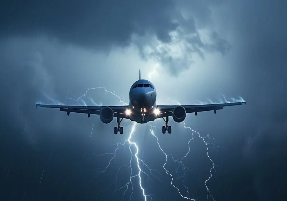
THE INCREASE IN TEMPERATURES CAUSES INCREASINGLY UNSTABLE ATMOSPHERIC CONDITIONS WHICH, IN TURN, CAUSE AN INCREASE IN TURBULENCE. A DRAMATIC EXAMPLE OF THESE EVENTS OCCURRED LAST 21 MAY ON BOARD A SINGAPORE AIRLINES AIRCRAFT FLIGHT FROM LONDON
The case of the Singapore Airlines plane
During the flight, the Asian company’s plane encountered such violent turbulence that in almost two minutes it fell over 6 thousand feet, i.e. over 1.800 metres. The accident caused the death of a passenger from a suspected heart attack and injured over one hundred people. Passengers who were not wearing their seat belts were probably thrown up and then fell sprawling onto their seats. Let’s delve deeper into the question
What turbulence is and why it happens
The turbulence they are a common phenomenon encountered by airplanes during flight. Close to the ground, strong winds around the airport can generate them during takeoffs and landings.
At high altitudes, ascending and descending flows of air can “dance” planes approaching the clouds. The latter are in fact made up of tiny droplets of water that are colder and denser than the air that surrounds them.
When an airplane passes through a cloud, the difference in speed, density and flow between the air inside and outside the cloud interacts with the aircraft’s wings, resulting in the shaking.
There are usually three triggering causes: the orographic waves of the mountains, the jet streams and thunderstorms.
Where did you orograph
Just like the waves crashing on the seafront, the air forms waves when it meets mountain ranges. One part passes the mountains and continues uniformly, the other piles up against the mountains themselves and can do nothing but rise upwards.
These “where did you orograph”i.e. mountain waves, can propagate in the form of large and light oscillations in the atmosphere, or they can divide into numerous tumultuous currents called turbulence, in fact
Jet streams
The jet streams, or jet stream, are narrow ribbons of strong winds found in Earth’s upper atmosphere, generally in the upper troposphere and lower stratosphere. These air currents move at very high speeds, which can exceed 300 km/h and are located at approximately 9-12 km above sea level.
Aircraft often use jet streams to save fuel and time during flight transcontinental flights. However, when crossing these currents, they can also encounter turbulence.
Thunderstorms and turbulence in clear air
While it’s intuitive that thunderstorms cause turbulence, researchers have found that they can generate it hundreds or thousands of kilometers away. This phenomenon is known as turbulence in clear air (Clear Air Turbulence – CAT).
Thunderstorms can affect jet streams. Fluctuations and changes in jet streams caused by thunderstorms can create turbulence at great distance from the storm. They generally occur in the absence of clouds.
The fearsome CATs
The “turbulence in clear air” they occur where wind shear (sudden wind variations influenced by air temperature) is very frequent. They are calls “clear” o “clear” because they normally occur at high altitudes, in cloudless skies and in the absence of storms.
Since 1979, when satellite observations began, wind shear at an aircraft’s cruising altitude has increased by 15%, and is estimated to increase by a further 17-29% by 2100.
Is it better to avoid traveling by plane?
«It’s not that we will have to stop flying, or that planes will start falling from the sky», dice Williams. «I’m just saying that if severe turbulence lasted ten minutes in the past, in the future it could last for 20 or 30 minutes.».
Classification of turbulence
Turbulence is also classified according to its intensity, which determines the effect on the aircraft and passengers: Mild (Light), Moderate (Moderate), Strong (Severe), Extreme (Extreme).
- Lieve (Light): Slight change in aircraft attitude. Movements of the plane barely perceptible to passengers. There are no significant flight safety concerns.
- Moderate (Moderate): Noticeable changes in the aircraft’s attitude. Passengers feel movement and loose objects may move slightly. They affect about 1% of the atmosphere at cruising altitude; the captain will likely recommend keeping your seat belts fastened.
- Forte (Severe): Large and sudden changes in the aircraft’s attitude. Difficulty for passengers to move and loose objects can move significantly. Injuries are possible, both among passengers and crew and even damage to the aircraft. When they occur, they require stringent security measures.
- Extreme: Extreme changes in aircraft attitude that may make it difficult to control the aircraft. Serious inconvenience for passengers and potential structural damage to the aircraft.
«Severe turbulence is what turns you into a projectile“, explains Paul Williamsatmospheric researcher ofUniversity of ReadingUnited Kingdom.
And if it is still unclear what type of turbulence caused the Singapore Airlines crash, one thing is certain: the climate change is making these phenomena increasingly frequent and above all dangerous. This is because the rising temperatures and changes in jet streams create more unstable atmospheric conditions.
This is supported by the atmospheric researcher Jung-Hoon Kim dell’Seoul National University. What’s worse, experts have found a significant increase in so-called CATacronym for “Clear air turbolenze” “turbulence in clear air”. What are we talking about?
Can turbulence be predicted?
The answer is no! In reality, pilots already use turbulence projections to plan flight routes. Researchers at meteorological centers can predict them based on data collected by terrestrial and satellite sensors and communicate any anomalies to them. On board the aircraft, the radar can also identify storm clouds to avoid.
However, these tools are not effective enough. Weather models fail to predict turbulence accurately at the individual airplane level. And pilots often make mistakes in reporting them, with a difference of several tens of kilometers.
Il National Center for Atmospheric Research (NCAR)has been working since 2005 to develop more precise tools that can identify turbulence through the so-called “nowcasting”.
How does nowcasting work?
And algorithmcurrently installed on approximately one thousand airliners, analyzes the information provided by onboard sensors to characterize the movement of each airplane in real time.
Using data on travel speed, wind speed, air pressure, roll angle and other factors, the algorithm generates a local atmospheric turbulence level on the computer. The information obtained is continuously fed back into the national systemimproving overall weather forecasts.
Currently, more than 12 thousand Delta Airlines pilots use tablets with this tool to monitor conditions along their flight routes. Recently the companies Qantas, Air France and Lufthansa have also adopted this technology.
Advantages of nowcasting
Implementing this algorithm offers several advantages:
- It has the ability to detect turbulence in real time with much greater accuracy than traditional models.
- Pilots can receive timely warnings about impending turbulence.
- Accurate information on atmospheric conditions helps optimize flight routes.
In addition to nowcasting, the LiDAR, a remote sensing instrument similar to radar, which allows you to determine the distance of an object or surface using a laser pulse, could guarantee fairly precise monitoring. Unfortunately, the costs are prohibitive.